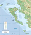
Fichier:Corfu topographic map-fr.svg
Apparence

Taille de cet aperçu PNG pour ce fichier SVG : 537 × 600 pixels. Autres résolutions : 215 × 240 pixels | 430 × 480 pixels | 688 × 768 pixels | 917 × 1 024 pixels | 1 834 × 2 048 pixels | 2 100 × 2 345 pixels.
Fichier d’origine (Fichier SVG, nominalement de 2 100 × 2 345 pixels, taille : 2,46 Mio)
Historique du fichier
Cliquer sur une date et heure pour voir le fichier tel qu'il était à ce moment-là.
| Date et heure | Vignette | Dimensions | Utilisateur | Commentaire | |
|---|---|---|---|---|---|
| actuel | 29 septembre 2008 à 13:54 |  | 2 100 × 2 345 (2,46 Mio) | Sting | + names of streams in Corfu |
| 4 septembre 2008 à 21:06 |  | 2 100 × 2 345 (2,44 Mio) | Sting | Using ETOPO1 bathymetry ; new standard colors | |
| 29 octobre 2007 à 16:49 |  | 2 100 × 2 345 (3,14 Mio) | Sting | "Pavllo" river name correction | |
| 16 mai 2007 à 01:16 |  | 2 100 × 2 345 (3,14 Mio) | Sting | International elevation key | |
| 30 mars 2007 à 00:51 |  | 2 100 × 2 345 (3,14 Mio) | Sting | Some additional place names | |
| 29 mars 2007 à 22:16 |  | 2 100 × 2 345 (3,13 Mio) | Sting | Locator map added; bathymetry more detailed | |
| 10 mars 2007 à 13:24 |  | 2 100 × 2 345 (3,07 Mio) | Sting | Some remaining text rendering bugs; more elevation references | |
| 9 mars 2007 à 23:49 |  | 2 100 × 2 345 (3,06 Mio) | Sting | Fixing rendering bugs | |
| 9 mars 2007 à 21:07 |  | 2 100 × 2 345 (3,06 Mio) | Sting | {{Information| |Description=Topographic map in French of the Corfu island area in Greece. |Source=Own work ;<br/>Background map : [http://www2.jpl.nasa.gov/srtm NASA Shuttle Radar Topography Mission] (SRTM3 v.2) (public domain) edited with [ |
Utilisation du fichier
La page suivante utilise ce fichier :
Usage global du fichier
Les autres wikis suivants utilisent ce fichier :
- Utilisation sur ar.wikipedia.org
- Utilisation sur en.wikipedia.org
- Utilisation sur fr.wikipedia.org
- Cartographie
- Inkscape
- Corfou
- Portail:Grèce antique/Image du mois/Archives
- Mont Pantokrátor
- Achilleion
- Histoire de Corfou
- Portail:Grèce antique/Image du mois/Archives/062007
- Wikipédia:Atelier graphique/Didacticiels cartographiques/Didacticiels pour la cartographie numérique géoréférencée
- Projet:Impression/Wikigraphistes
- Incident de Corfou
- Discussion Wikipédia:Atelier graphique/Archive 10
- Utilisation sur ro.wikipedia.org
- Utilisation sur tg.wikipedia.org


